Larry Angier/Image West Photography

What's in a Name?

From Pie Town to Snowflake, a place's name can be a clue to its unique history or features.

Courtesy of Nita Larronde

Alyssa Morris won a ribbon last year for her strawberry-kiwi pie.

Alyssa Morris is a fifth-grader from Gilbert, Arizona. She visits her grandmother in Pie Town, New Mexico, every September. That’s when the tiny community hosts its annual Pie Festival. “My favorite part is that we get to bake pies and enter them in a contest,” Alyssa says.

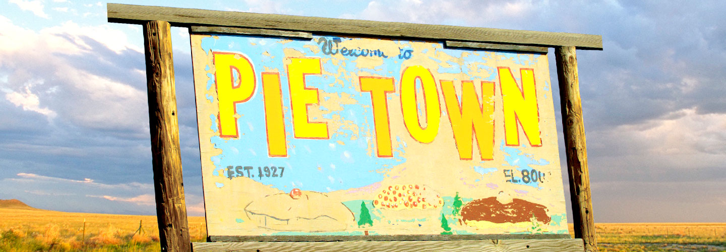
Pie Town’s name hints at its history. It was once a rest stop for cowboys moving herds of cattle further east. In the 1920s, a businessman started selling supplies and food—including pies— to the cowboys and other travelers. His pies became so popular that the spot became known as Pie Town, and the name stuck!

Jon Arnold Images Ltd/Alamy Stock Photo

Mexican Hat Rock

Pie Town isn’t the only place in the U.S. with an unusual name. Many other towns and cities have unique names too. Some are named after local natural features, like Mexican Hat, Utah. It’s home to a rock formation that looks like a hat called a sombrero, turned upside-down. Other places honor people. In fact, Snowflake, Arizona, isn’t named after snow, but after its two founders. It combines the last names of Erastus Snow and William Flake.

A name might also reflect how a place came to be. The city of Westwego, Louisiana, was a key crossing point for people moving west in the late 1800s. As one story goes, when those people passed through the area, they shouted, “West we go!”

In some cases, there’s a funny story behind a name. One town in Georgia got its name after the post office kept rejecting residents’ suggestions. Frustrated, the town decided to go with Nameless!

But why do places need names at all? We use maps to show us the exact locations of places and to find out how to get from one spot to another. You would have a hard time finding a town, city, or country on a map if it had no name. The post office would have a tough time delivering people’s mail too!

Jim McMahon/MapMan®
borders

the official lines that divide states, countries, or regions


Oklahoma shares its borders with six states.

iStock/Getty Images
capitals

the cities in countries or states where the government is based


Washington, D.C., is one of the world’s most famous capitals.

©Deb Snelson Photography/Moment RF/Getty images
towns

places where people live and work that have things like houses, stores, and schools, and are smaller than cities


Many small towns in the U.S. have a main street where people shop, like this one in Telluride, Colorado.

Jim McMahon/MapMan®
political map

a map that shows the governmental boundaries of countries and states, shows the location of capitals, cities, and towns, and usually includes major bodies of water


This political map of the United States shows all 50 states and their capitals.

videos (2)
videos (2)
Text-to-Speech